Raging River Mountain Bike Trail Guide
By: Asa Redfield, Digital Content Editor | Last Updated: May 15th, 2024
Mountain biking in Seattle has never been better - with miles after mile of brand new trail opening every year thanks to the hard work of Evergreen Mountain Bike Alliance and volunteers from the community. The Raging River mountain bike trail system in the Rattlesnake mountain area off I90 is perhaps the greatest testament to this new bounty, with a whole new trail system coming into existence and continuing to improve year after year. The system has a great variety of trails, offering riding for beginners through to experts making it one of the most popular trail areas in Seattle.
The backbone of the Raging River mountain bike trails is the original “lollipop” a ride just under 20 miles, with a whole lot of great climbing and descending. From these original trails. New options are being built all over the mountain. In the years to come, there will be many new loops and options.
There are essentially two sides to Raging - the front side, with easier flow trails, and the backside which has some great rooty and raw advanced and expert riding. The Raging river lollipop combines these all. Keep in mind - the backside riding is deep in the backcountry and without cell service, and make your risk assessment accordingly.
| Total Trails | 8 | Difficulty | Beginner through Expert |
| Total Distance | 46+ miles | Total Vertical | 2,818' |
| Local Advocacy Group | Evergreen Mountain Bike Alliance |
Popular Trails at Raging River
Upward Mobility
Trailforks | MTB Project
Beginner | 3 Miles | 1,059’ Climb
Every mountain bike ride at Raging River starts with Upward Mobility, a great climbing-only trail. Smooth and steady, this is the way to access all of the great descending here. From the top of Upward Mobility, you have the choice to continue up the 2-way Raging Ridge trail or to descend Poppin’ Tops.
Raging Ridge
Trailforks | MTB Project
Intermediate | 6 Miles | 1,738’ Climb
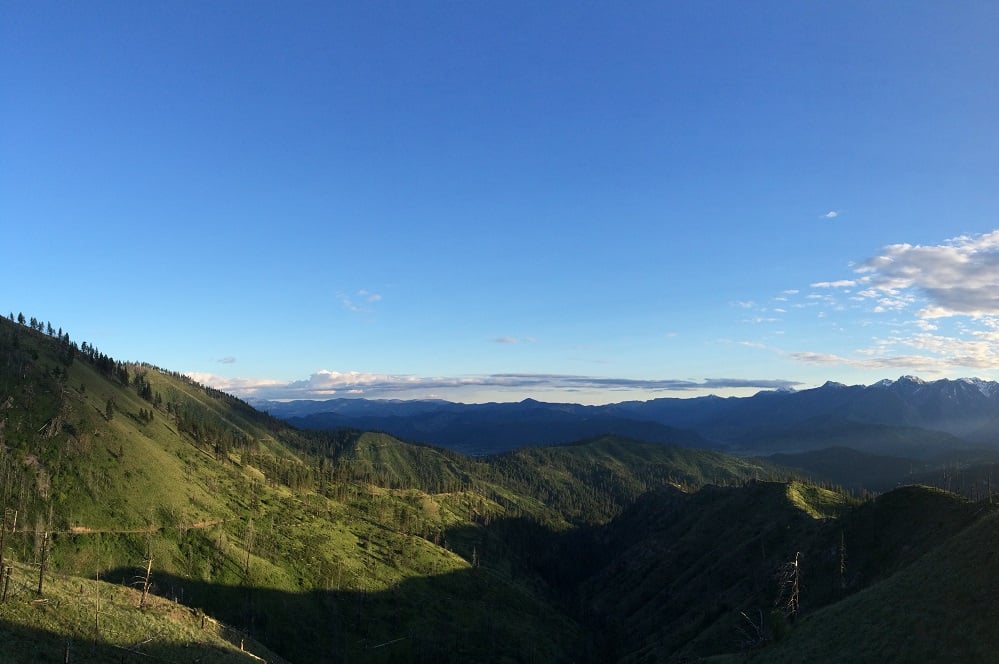
The two-way Raging ridge trail climbs from Stan’s Lookout and the top of Upward Mobility to the highest point, and one of the best views, at the trail system. The climb is once again steady, and perhaps a bit steeper than UM. On the way down, the ridge is a great time, with smooth tread and good site lines. Make sure to be aware of and yield to climbing riders, however.
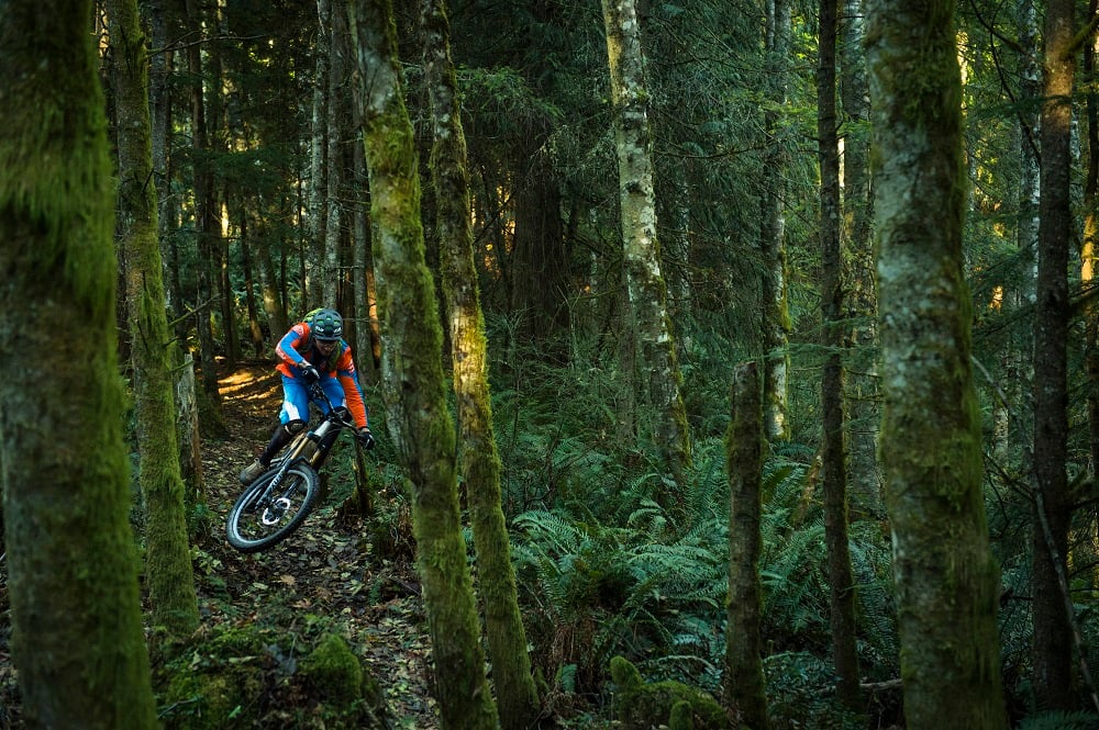
Poppin Tops
Trailforks | MTB Project
Advanced/Intermediate | 1 Mile | 520’ Descent
Dropping from Stan’s Lookout, Poppin Tops is a flowy good time. The most intimidating feature is probably the first steep switchbacking turn, apart from that, it’s high-speed flow with lots of double rollers and tabletops to jump. This is one of evo’s favorite mountain bike trails in Seattle, with our employees fighting from that Strava KOM to boot. However, it is not a good trail to ride in the rain and wet conditions.
Flow State
Trailforks | MTB Project
Intermediate (Upper) Beginner (Lower) | 1 Mile | 529’ Descent
Flow State is simply one of the most fun pieces of mountain bike trail in Washington. The lower section is easy enough for beginners and kids, however, advanced riders shouldn’t write the trail off - it’s smooth and filled with great berms, something everyone can enjoy. This is a great way to finish your Raging River ride and a good test for beginner riders gaining their confidence.
No Service
Trailforks | MTB Project
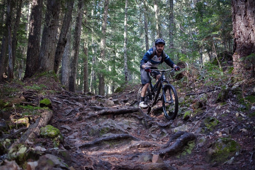
Advanced | 2 Mile | 1,254’ Descent
No service is about as fun as mountain biking can get. Dropping down the backside, this trail has a little bit of everything, from fast and technical root sections to some awesome flat-out flow. The first section is the most technical, with roots aplenty. This can be a slippery and challenging descent, and it can stay wet longer after storms on this side of the mountain. The middle section relents on the technicality and turns up the “weee!” factor, with a nice flow section with small tables and rollers - no mandatory gaps. Finally, the trail finishes back on a technical note. There are no large features, just lots of small ones with good flow to keep you on your toes.
The People's Elbow
Trailforks | MTB Project
Expert Rock Roll
Taking its name from the infamous Dwayne “The Rock” Johnson’s signature maneuver, The People’s Elbow is more of a feature than a trail in its own right, but it’s a stout one. This rock roll is one of the more intimidating and gnarly features in Washington.
Invictus
Trailforks | MTB Project
Expert | .666 Miles | 725’ Descent
If you conquered the rock and want to keep sending it, Invictus is your next fork off of No Service. This trail is like a steeper, rougher version of No Service, and definitely earns its expert designation. Some riders consider this the hardest mountain bike trail in Washington.
Return Policy
Trailforks | MTB Project
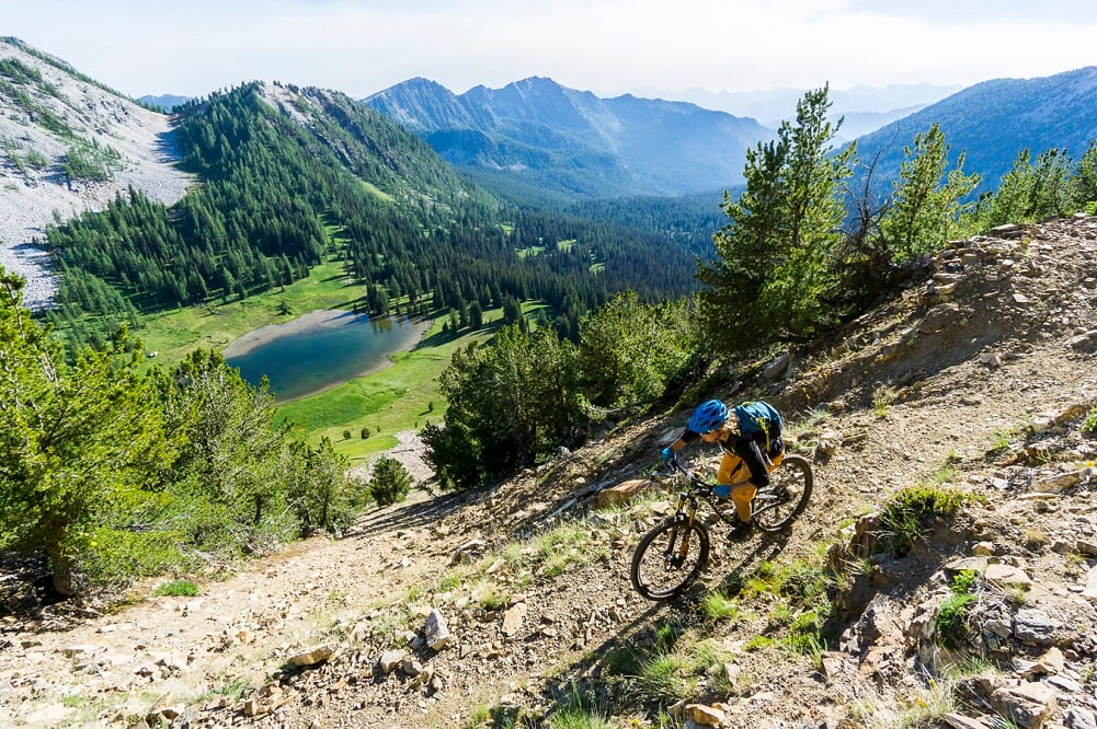
Intermediate | 2 Mile | 1,047’ Climb
There’s no way around it, Return Policy is a grunt of a climb. After descending the backside of Raging River, this is how you climb back out to the front side - there’s no alternate route. Lots of switchbacks and a constant steep grade, this will test your fitness. Just remember - you get to descend again at the top!
Common Raging River Routes and Mountain Bike Rides
Raging River Loop - "Lollipop"
Trailforks | MTB Project
Advanced | 19 Miles | 3,657’ Climb/Descent
The full Raging River Lollipop climbing Upward Mobility and Raging Ridge, descending No Service, Climbing back out Return Policy, then descending Raging Ridge to Poppin Tops and Flow State. This is a big, fun ride that will take 3-5 hours depending on your fitness and pace. Take plenty of water and snacks. There is no cell phone service on the backside - ride with caution!
Frontside Flow Lap - "Up, then Flow"
Trailforks
Intermediate | 5 Miles | 1,100’ Climb/Descent
This is a fun short ride that loops the climbing trail and the two flow trails on the front side of the Raging River mountain bike trail system. This is a nice after-work lap or a good challenge for intermediate riders or advanced kids.
How to Get to Raging River Trailhead - Parking & Directions
The Raging River mountain bike trails are located off of I-90, 27 miles east of Seattle. To get to the trailhead, take Exit 27 off of I-90, and head south, then up the hill a short way to the trailhead - it’s hard to miss the Raging River trailhead, as the road dead-ends here. If you’re plugging in directions to your phone, Snoqualmie Point Park is a good landmark to look up, or the Rattlesnake Mountain Trailhead. Keep in mind this is NOT the popular Rattlesnake Lake or Rattlesnake Ledge parking area. Parking in the upper lot requiers a Discover Pass; those without can park along Winery Rd.
Typical Weather & Riding Conditions
As one of the best mountain bike trail areas close to Seattle, Raging River is a popular spot. However, even on crowded summer weekends, there is plenty of trails to spread people out. While Washington has some great riding all year, Raging River is not the best winter riding destination in the area. The upper trails get snow, and conditions and dirt can be muddy and slippery on the flow trails. Riding here during very wet periods can damage the trails, too. The trails on the backside typically stay wet longer after storms, which is both good and bad, as it can be slippery, but the dirt also stays good in the dry summers.