Galbraith Mountain
Mountain Bike Trail Guide
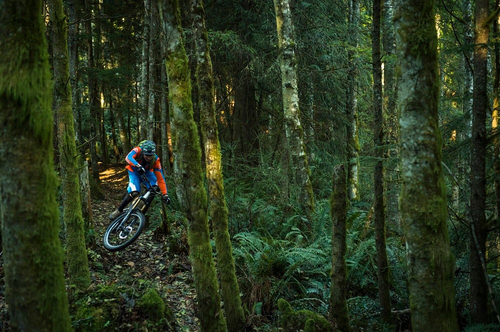
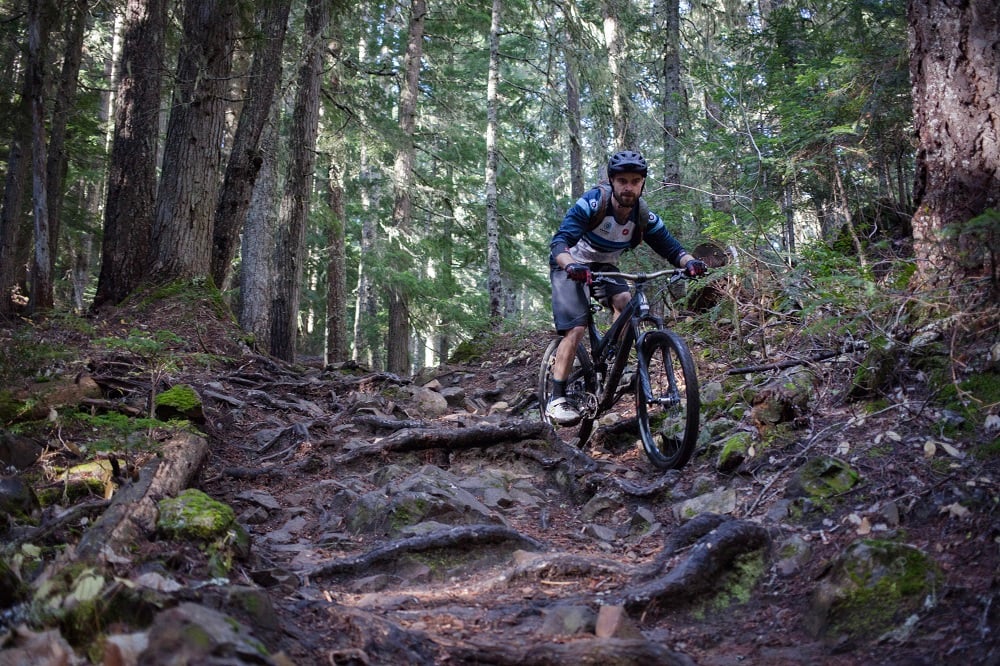
Galbraith Mountain offers mountain bikers of all abilities an amazing selection of world-class bike trails, all within riding distance of downtown Bellingham. The trail system at Galbraith spans over 3,000 acres just southwest of town with mountain bike trails climbing up and down through the mossy Pacific Northwest forest. There are trails of all different styles, with the majority falling into the cross country and all-mountain categories, with some super fun jump and feature laden descents. In total, there are over 100 mountain bike trails at Galbraith. While the area is completely inter-connected, there are two main sides of Galbraith, the north side and the south side. Located at a low elevation, the mountain bike trails at Galbraith can be ridden all year long, too, adding yet another awesome aspect to this Bellingham riding area.
| Total Trails | 138 | Difficulty | Beginner, Intermediate, Advanced, Expert |
| Total Distance | 78 miles | Style | XC, All-Mountain, Enduro, Freeride |

evo's Favorite Trails
South Side
Three Pigs
Intermediate | 1.7 Miles | 566' Climb
Three Pigs is an awesome climbing trail that gains 566’ towards the summit over 1.7 miles of singletrack. While many more gravity oriented riders prefer to climb up via the roads, this trail is a nice option for riders that prefer to climb on singletrack. From the top, riders can hop on a road to the top. To keep climbing on trails, the summit can be accessed by continuing from Three Pigs to Kaiser, Bottle Opener, Keystone, and Wonderland.Evolution (Evo) & Scorpion
Advanced | .56 Miles | 47' Climb | 244' Descent
This pair of advanced trails descends from the summit of Galbraith. Both trails feature a nice selection of ladders, drops, and jumps. Scorpion is the more difficult of the two, with a steeper pitch and bigger features.Unemployment Line AKA U-Line
Intermediate | .73 Miles | 386' Descent
Unemployment line, AKA U-Line, is one of the signature trails at Galbraith Mountain. Starting at the end of Scorpion, U-Line drops in with some awesome machine-built flow. There are huge berms, and over forty jumps throughout the trail. Pretty much all of the features are rollable, with only a couple gaps. More advanced riders will love lining up the bigger jumps, doubles, and feeling the flow. Atomic Dog AKA A-Dog
Intermediate | .71 Miles | 399' Descent
Atomic Dog is another Galby classic, with more fun flow and some jumps. This trail is a little bit more technical than Unemployment line, but still super fun. It drops from the end of Pump Track and Unemployment Line to the bottom of Galbraith Mountain.North Side
The Ridge
Intermediate | 1.4 Miles | 686' Climb
The Ridge is the most popular way to access the north side of Galbraith. It climbs pretty straight for the 1.4 mile duration. The constant climb mixed with ample roots and rocks is certainly a fitness challenge. There are opportunities to bail onto the more forgiving access road.SST
Intermediate | 1.5 Miles | 716' Descent
SST is one of the most popular mountain bike trails at Galbraith, and for good reason. It is long, fast, flowy and fun. Despite its intermediate rating, SST is a really fun trail for mountain bikers of all abilities. There are jumps everywhere on the trail, but they are all roller doubles, or tabletops, that can be rolled over by riders that aren’t ready for airtime. Oriental Express
Intermediate | .93 Miles | 583' Climb | 520' Descent | 00:20:54 avg time
Oriental Express branches off the top of SST and is a really fun descending trail, too. For the most part, the trail is more natural singletrack style, as opposed to the more built out berms and features on SST. there are some berms and jumps on Oriental Express, however. Grasshopper
Advanced | .34 Miles | 245' Descent
Grasshopper is one of Galbraith's newest and burliest jump trails. The poppy and fun jumps are reminiscent of some of the freeride trails in the Whistler Bike Park. There are large ladder drops, gaps, and step-ups throughout. The middle section of the trail has great pedal-free flow and a handful of fun gaps.Common Routes and Rides
South Side Loop
| Total Distance | 6.4 Miles | Difficulty | Intermediate & Advanced |
| Elevation Gain | 1,282' | Style | All-Mountain, & Enduro |
| Climb | Three Pigs → Galbraith Lane (forest road) | Descend | Evo or Scorpion → Unemployment Line or Pump Track → Atomic Dog |
South Side Loop (All singletrack climbing)
| Total Distance | 9.7 Miles | Difficulty | Intermediate & Advanced |
| Elevation Gain | 1,840' | Style | XC, All-Mountain, & Enduro |
| Climb | Three Pigs → Kaiser → Bottle Opener Happy Hour → Wonderland |
Descend | Evo or Scorpion → Unemployment Line or Pump Track → Atomic Dog |
North Side Loop
| Total Distance | 5 Miles | Difficulty | Intermediate, Advanced |
| Elevation Gain | 1,442' | Style | Enduro, All-Mountain |
| Climb | Ridge Trail → Cedar Dust → RD 2400 (The Wall) → SST Access Road |
Descend | SST → Backdoor |
Wondering how to get to Galbraith Mountain? There are parking lots available at both the north end and south end of Galbraith, or mountain bikers can ride right from town. The parking lot on the South side is located off of South Samish way, while the north side parking lot is off of Lakeway Drive near Whatcom Falls Park.
The mountain bike trails at Galbraith Mountain can be ridden all year long. There will be puddles in places during the winter, and on the upper trails. It takes about five days to fully dry out after a large rainstorm.